The resources are in! It looks like a sustainable (or not) development plan. While the opinion shapes up, have a look at this - it is a useful starter for you.
www.wikifieldtrip.org/Pennbury
Tuesday, 20 November 2012
Sunday, 7 October 2012


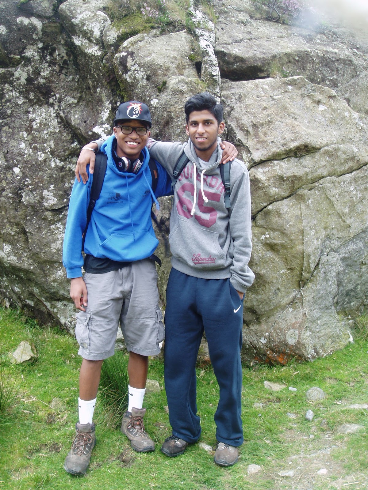
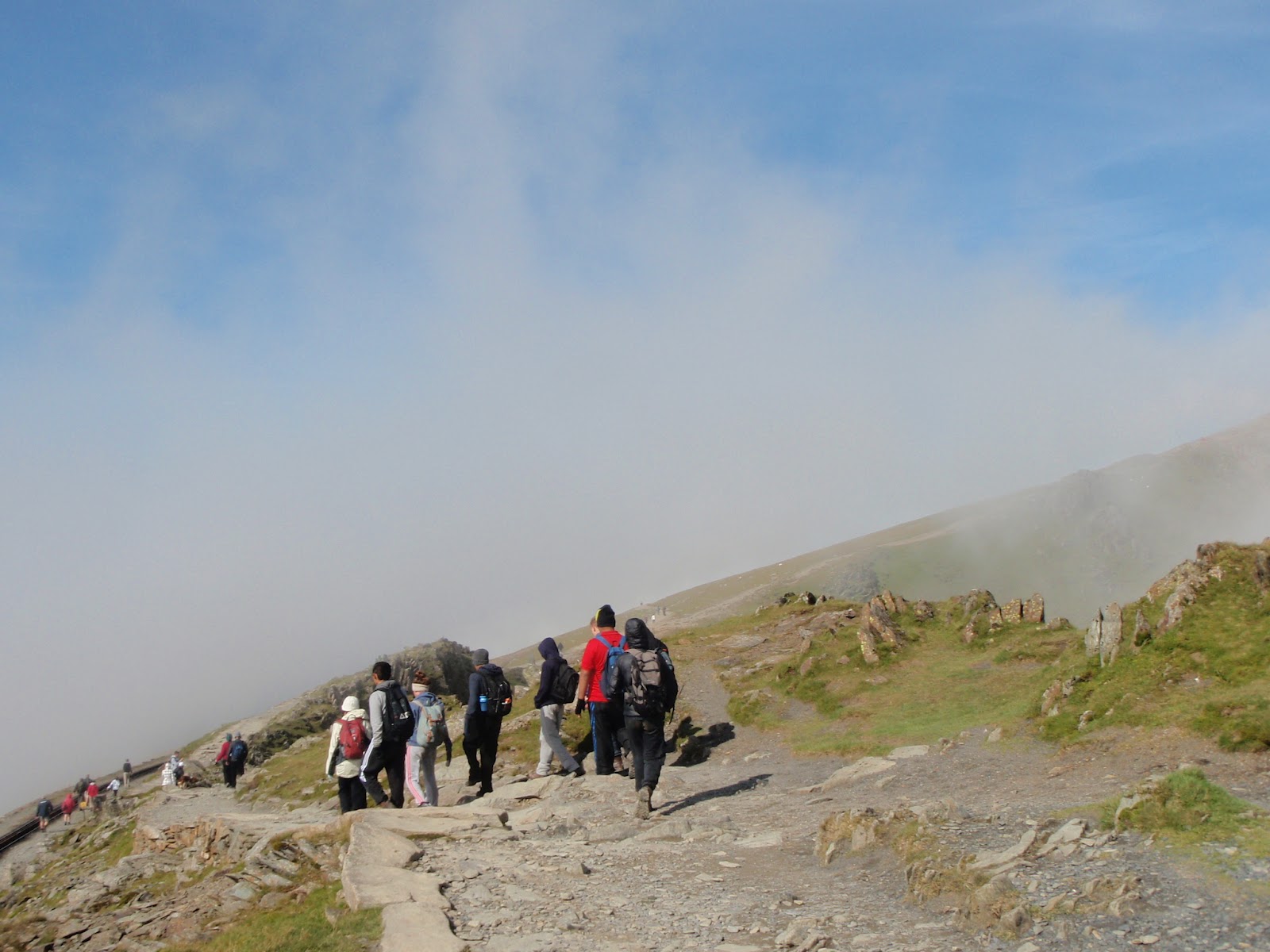
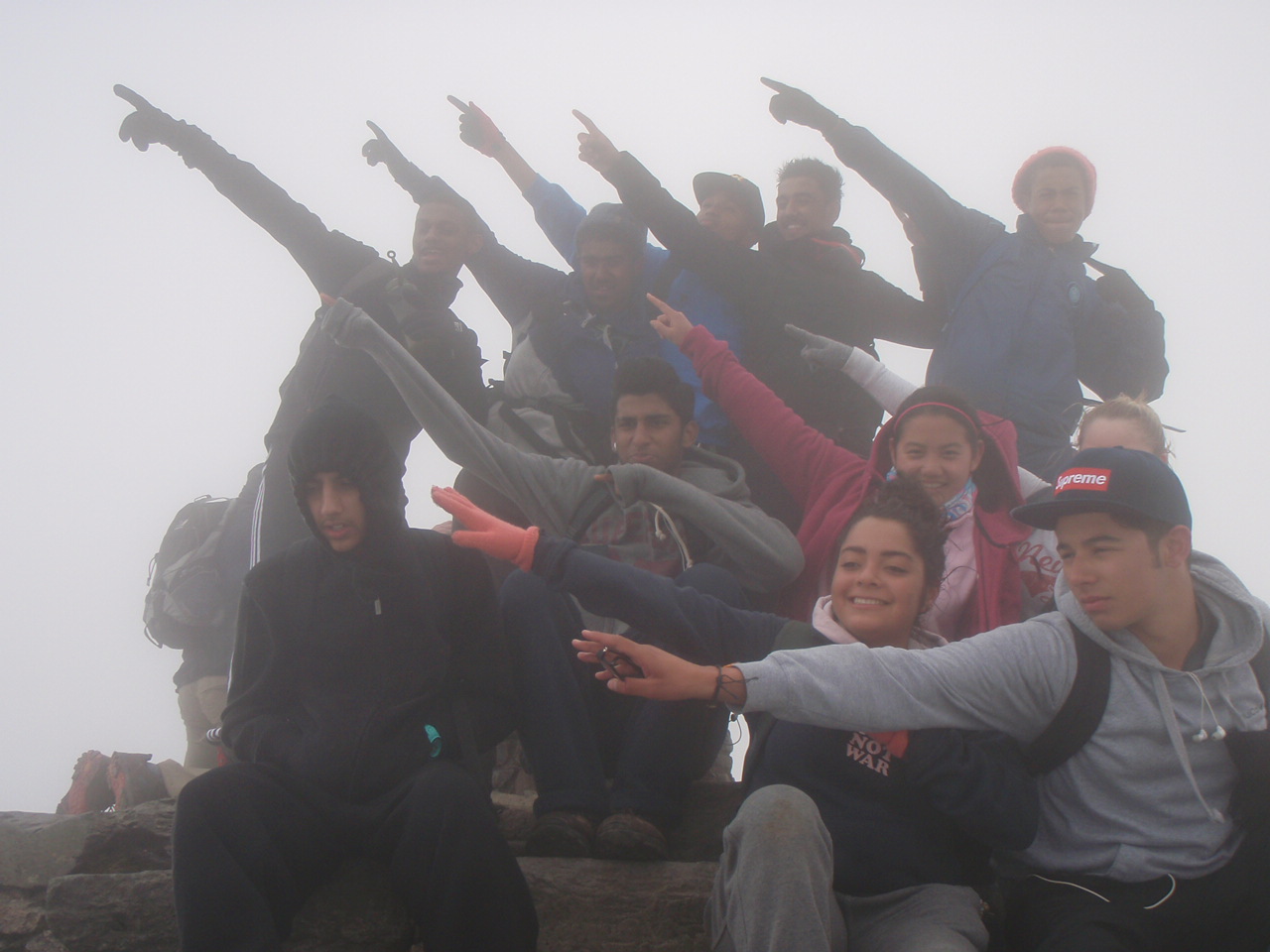
.......and for many, the highlight of the week - a walk to the summit of Snowdon, which at 1085 metres, is the highest peak in Wales and England. Three groups were chosen according to the route - one to climb the Watkin Path, one to branch off to follow the South Ridge and the third starting at Pen-y-pass to follow the Miners' Track, then to the top via the Pyg Track. Although the weather forecast warned of sun as the main hazard, a south-westerly wind brought moist air from Cardigan Bay, so clothing the southerly flanks in thick cloud. Unfortunately, this meant that once at the summit, there was no view. However, the wind direction meant that the descent via the Pyg Track was enlivened by the sight of clouds flowing over the summit and evaporating on the north-eastern side. All managed the ascent and descent successfully and took away memories of their achievement and the mountain itself.


Friday, 5 October 2012
Wednesday 5th September
A beautiful morning and its off to the delights of sunny Llandudno. On the way there is a stop in the small Conwy Valley town of Llanrwst to have a quick look at the £7 million flood defences installed to help protect the town protect itself for when the river bursts its banks like it did in 2004 and 2005.


A beautiful morning and its off to the delights of sunny Llandudno. On the way there is a stop in the small Conwy Valley town of Llanrwst to have a quick look at the £7 million flood defences installed to help protect the town protect itself for when the river bursts its banks like it did in 2004 and 2005.
 | ||
 |
 |
| Above map courtesy of http://www.environment-agency.gov.uk/homeandleisure/floods/38435.aspx |
Then it was on to Llandudno, a smart seaside town that has managed to retain its air of gentility despite the changes in holiday habits that has caused decline for so many of the UK's seaside resorts. The development of the town was studies, how it grew up on a sandy tombolo linking the limestone headland of the Great Orme to the mainland. The Mostyn estate still owns the land and strictly enforced covenants ensure that buildings are maintained and the town retains a crisp and cared-for appearance. Today, it is the main shopping centre for the North Wales coast, this being evident by the bustling main thoroughfare of Mostyn Street. Certainly, the sunny almost Mediterranean skies helped present the town in a most favourable light.


Tuesday, 4 September 2012
Fieldwork in Snowdonia
 "How natural is your chosen stretch of river?" - that is the question. So off to Migneint Moor in the Snowdonia National Park to find the answer. The renewal of cattle grids prevented the coach from going any further that Ysbyty Ifan, the highest village on the river, so a system of mini-bus shuttles had to be set up to travel further up the river. Firstly, however, measurements such as width, depth, wetted perimeter and sediment size and roundness were taken.
The village has been prone to flooding. The ancient bridge interrupts the flow of the river and sediment has built-up on the upstream side, restricting the river channel. In the photo (LH) a small wall can be seen protecting the cottages. In the photo above, the coach is standing on top of the flood defence bank built in the early 1990's. Here then, the river has been managed to help reduce the risk of flooding.

 Up onto Migneint Moor, where although there are no settlements, the land is used for rough grazing of sheep. This will have altered the hydrology of the area by removing scrub vegetation and replacing it with peat bogs and rushes. In the past, this area was heavily glaciated, creating a flat bottomed valley which subsequently was filled with sludgy material as the ice melted - solifluction. This resulted in a flat floor to the valley which has encouraged the formation of meanders, a feature more usually found in the lower course of a river.
 Finally on to one of the tributaries of the Conwy, Nant-y-brwyn. A classic V-shaped valley with outcrops of slate. the stream tumbles through a series of pools and riffles. Although the water looks like it is flowing quickly, the friction from the boulders slows it down.
Here the features might be natural but the land itself has been altered heavily by farming. The impermeable rocks and saturated peat result in faster rates of runoff, which in turn lead to flooding further downstream - a problem the town of Llanrwst knows only too well.
Wednesday, 4 July 2012
Field-work in Rochester.

Tuesday 19th June and the day promises to be one of the few in the month to be dry and sunny. Ideal then to spend it studying the central area of Rochester in Kent. The High Street has changed over the years, perhaps reflecting the need to develop a more distinctive character than the "clone town" so often seen these days. Although banks have closed and some of the more unusual shops have disappeared, there is a general smartening in the shops and a wider range including delicatessens and coffee bars and pizza restaurants. the chain store is rare here, maybe because Bluewater is just 15 minutes away via the A2. Few high streets can compete with such a large concentration of national names, so Rochester seems to be reinventing itself as a quirky tourist destination, even if the references to Charles Dickens come thick and fast.
The castle's Norman keep provides an ideal platform from which to assess the site of teh city. Built on the Medway, just a few kilometres from the sea, the spot chosen by the Romans to cross the river is still the site of the modern city. The view from the keep looks out over the double meander that must have been an obstacle to any invader trying to wend their way inland. Look the other way and the M2 and the high speed rail line to the Channel Tunnel can be seen crossing on high bridges to the south.

Sunday, 1 July 2012

Gentrification - An issue worth studying.
Even with the property market in stagnation and homelessness becoming an even greater problem, some areas seem immune. The BBC TV series "The Secret History of Our Streets" has been a fascinating chronicle of how London's residential areas have changed over time. The link below will take you to the BBC article about Portland Road in Notting Hill where the property prices are frightening, as is the social divide!
http://www.bbc.co.uk/news/magazine-18394017
Thursday, 24 May 2012
Holderness Coastal Erosion

A popular case study of the causes and problems of coastal erosion experienced in some parts of the UK. This became national news in 1997 when Sue Earle had to vacate her farm at Great Cowden just to the south of Mappleton and pay £3000 demolition costs. She is suing as she claims the construction of the rock groyne to protect the coastal road passing through Mappleton, starved the beach below her farm of the sediment it needed so accelerating the rate of erosion. This video from the BBC looks at another farm in danger of disappearing, so joining the increasing list of settlements lost to the sea since Roman times.
Friday, 11 May 2012
Beware of unsolicited rubbish!
Today we received a DVD in the post from an organisation called Truth in Science. The notes on the box claimed to show a new view of the formation of the Earth. Naturally, a quick trawl of the internet confirmed our suspicions that this nonsense comes from a creationist front using films made across the Atlantic . What is so disturbing is that nowhere on the box or the accompanying literature is this made clear - obviously a rather futile attempt to hide their true identity. Goebbels would have been proud. Avoid at all cost!
Today we received a DVD in the post from an organisation called Truth in Science. The notes on the box claimed to show a new view of the formation of the Earth. Naturally, a quick trawl of the internet confirmed our suspicions that this nonsense comes from a creationist front using films made across the Atlantic . What is so disturbing is that nowhere on the box or the accompanying literature is this made clear - obviously a rather futile attempt to hide their true identity. Goebbels would have been proud. Avoid at all cost!
Monday, 7 May 2012
A2 6GEO3 Synoptic Pre-release is now out. As expected the subject is based on the Water Conflicts unit with the Himalayas as water source for trans-boundary water supplies. Highly topical given the state of the world's water supplies.
Edexcel Advance Information
Edexcel Advance Information
Thursday, 23 February 2012

http://www.bbc.co.uk/iplayer/episode/b01c9wdv/The_Great_British_Countryside_Cornwall_and_Devon
The second, on Yorkshire was shown this evening and will be available soon on BBC iPlayer.
It looks like a series worth sticking with if you want to understand our landscapes and the way they have shaped us as a nation.
Friday, 3 February 2012
Jammin' in Torquay
 |
| In the seafront gardens |
Thursday 2nd February.......
Today the sun shone in the sky from the moment the day arrived. A good day to visit Torquay, the Jewel of the English Riviera, a place which attracts people from all over Britain. |
| Listening at the harbour |
 |
| Torquay and its harbour |
After a quick break for lunch (turkey sandwich at Torquay, ha ha), it was time to analyse the Goad maps. Goad maps are high detailed maps showing all the shops of the city/town. The analysis showed that some chain stores were still there after 20 years and some independent shops were substituted by other chain stores or restaurants.
Torquay, being known as a holiday resort makes it an attractive place right from the start and from what we saw it's still doing that job today.Sara and Vikas
Torbados by locals, written by Hoodie BigCol , performed by LadyV.
It is a parody of Alicia Keys' song and paints quite a different view of Torquay.
Thursday, 2 February 2012
Arctic Winds on the Devon Coast
Wednesday 1st February.........
We were looking forward to a nice long stroll along the coast. If it wasn't for the arctic winds, we would have had that! We started at the aptly named Start Point, and shivered in a -5C wind chill factor while we posed for the group photo.
First stop was at Hallsands, a ruined village which was destroyed in 1917 by the mismanagement of the fragile coastline. The shingle was dredged from the bay to make concrete for the expansion of Devonport Dockyard in Plymouth. Sir John Jackson who was commissioned to build it, failed to understand how the sediment cell in Start Bay functioned. Consequently, the beach in front of Hallsands disappeared in a matter of years, leaving the village to face the brunt of the North-easterly winds.
Further up the coast, the engineering constructed to protect the village of Beesands was examined. Sea walls, gabions and rip-rap are used extensively for this purpose. We used a variety of methods, including bi-polar and cost-benifit analyses to determine the effectiveness of the defence schemes. A do-nothing scheme north of Beesands was also implemented where the land is not worth the expense of protecting. This allowed us to contrast the effects of these coastal defences. Further to the north, similar methods were used in the village of Torcross, except on a much larger scale, because of a violent storm that hit in January 1979. Finally, we looked at shingle bastions, which are a more sustainable way of protecting the coastline.
Despite the bitter, ice cold winds, and the relief of being back at the field centre, which never seemed more inviting, it was a very worthwhile day.
Ashley & Anthony
 |
| Freezing at Start Point |
 |
| Hallsands ruined village |
 |
| Beesands village showing different types of coastal defence. |
Further up the coast, the engineering constructed to protect the village of Beesands was examined. Sea walls, gabions and rip-rap are used extensively for this purpose. We used a variety of methods, including bi-polar and cost-benifit analyses to determine the effectiveness of the defence schemes. A do-nothing scheme north of Beesands was also implemented where the land is not worth the expense of protecting. This allowed us to contrast the effects of these coastal defences. Further to the north, similar methods were used in the village of Torcross, except on a much larger scale, because of a violent storm that hit in January 1979. Finally, we looked at shingle bastions, which are a more sustainable way of protecting the coastline.
 |
| Stone sampling |
 |
| Torcross with its sea-wall |
Despite the bitter, ice cold winds, and the relief of being back at the field centre, which never seemed more inviting, it was a very worthwhile day.
 |
| With the memorial Sherman tank in Torcross |
Tripping out in Totnes
Tuesday 31st January.......... |
| In Totnes Town Hall Square |
 |
| All at sea with Caterham Geographers |
Small businesses trying to keep the cash flow within the town, started up their own currency called the 'Totnes Pound'. Interviews with local traders suggested that the currency was used by tourists as well as locals. However by interviewing the general public we found that it was not used in all shops which made accessibility to the currency hard. We all found Totnes to be a unique town and a general welcoming which shows a sense of community.
 |
| Incredible edibles - community food supply in Totnes. |
The day finished with a visit to Riverford farm which has grown from a local farm into a national organic supplier. We looked inside the shop and tried to compare the goods to those in Totnes. Riverford supply a wide variety of local produce available through its vegetable delivery scheme. Overall we learnt that rebranding can vary from place to place and can itself create challenges for the communities involved.
This video explains the way Totnes involves its inhabitants in the transition town way of living.
Darren and Hassan
Eight go Wild in Plymouth.
Eight go Wild in Plymouth.
Monday 30th January....
Rain. Rain. RAIN!! blurgh :(
The day starts with a warm shower, challenged by the cold outside. A quick brief told us where we would be heading today. Destination: Plymouth
The forty five minute drive with a driver who is.. well... hmmm.. not bad :S
First stop: The Hoe
A red and white lighthouse stands on the green where Sir Francis Drake continued to play bowls despite imminent approach of the Spanish Armada.
Here, surrounded by the history, we studied the events which made Plymouth such an important city.
Second Stop: Frankfort Gate and the Covered Market. Here, we assessed the attempts to rebrand this part of the city centre by creating an independent quarter. We assessed this by using Environmental Quality Index, Index of Decay, Pedestrian Count and Perception Study.
Third stop: Drake Circus; using the same techniques, we assessed the success of this most modern addition to Plymouth's retail landscape. This under cover shopping precinct contrasts starkly with the closed shops fourth down the hill in the city centre.
Fourth Stop: The Historical Barbican District, site of the Mayflower steps whence the Pilgrim Fathers are said to have departed for a new life in the New World.
An interesting area full of potential which was dampened by the dismal weather.
Last stop: Royal William Yard, an exciting new developed by Urban Splash, which is bringing modern loft-living to a historical complex of buildings which was once the Royal Naval Victualling Yard.
The End.
Charlotte and Jordan, Caterham Geographers
 |
| Ready for the off. |
Rain. Rain. RAIN!! blurgh :(
The day starts with a warm shower, challenged by the cold outside. A quick brief told us where we would be heading today. Destination: Plymouth
The forty five minute drive with a driver who is.. well... hmmm.. not bad :S
First stop: The Hoe
A red and white lighthouse stands on the green where Sir Francis Drake continued to play bowls despite imminent approach of the Spanish Armada.
Here, surrounded by the history, we studied the events which made Plymouth such an important city.
Second Stop: Frankfort Gate and the Covered Market. Here, we assessed the attempts to rebrand this part of the city centre by creating an independent quarter. We assessed this by using Environmental Quality Index, Index of Decay, Pedestrian Count and Perception Study.
Third stop: Drake Circus; using the same techniques, we assessed the success of this most modern addition to Plymouth's retail landscape. This under cover shopping precinct contrasts starkly with the closed shops fourth down the hill in the city centre.
 |
| Drake Circus shopping centre |
 |
| Empty retail space in the city centre. |
Fourth Stop: The Historical Barbican District, site of the Mayflower steps whence the Pilgrim Fathers are said to have departed for a new life in the New World.
An interesting area full of potential which was dampened by the dismal weather.
 |
| Running from the Urban Splash cows |
 |
| Ahoy there! |
The End.
Charlotte and Jordan, Caterham Geographers
Monday, 23 January 2012
A2 students sitting the forthcoming 6GEO4 Geographical Research Paper might find this useful. It is taken from today's BBC News website and might be relevant when looking at hazards over time.
23 January 2012
Last updated at 15:29
 The 2011 quake caused massive destruction on Japan's north-eastern coastline
The government says the chances of such an event are 70% in the next 30 years.
The warning comes less than a year after a massive earthquake and tsunami devastated Japan's north-eastern coast.
The last time Tokyo was hit by a big earthquake was in 1923, when a 7.9 magnitude quake killed more than 100,000 people, many of them in fires.
Researchers at the University of Tokyo's earthquake research institute based their figures on data from the growing number of tremors in the capital since the 11 March 2011 quake.
They say that compared with normal years, there has been a five-fold increase in the number of quakes in the Tokyo metropolitan area since the March disaster.
Correspondents say that while the university calculations take account of greater seismic activity since March, government calculations may use different or less up-to-date data and different modelling techniques.
The 9.0 magnitude earthquake last year aksi crippled the cooling systems at the Fukushima nuclear power station, causing meltdowns in some of its reactors.
Japan is located on a tectonic crossroads dubbed the "Pacific Ring of Fire" which is why its is commonly regarded as one of the world's most quake-prone countries, with Tokyo located in one of the most dangerous areas.

Big Tokyo earthquake likely 'within the next few years'
The 2011 quake caused massive destruction on Japan's north-eastern coastline
The
chance of a big earthquake hitting the Japanese capital in the next few
years is much greater than official predictions suggest, researchers
say.
The team, from the University of Tokyo, said there was a 75%
probability that a magnitude seven quake would strike the region in the
next four years. The government says the chances of such an event are 70% in the next 30 years.
The warning comes less than a year after a massive earthquake and tsunami devastated Japan's north-eastern coast.
The last time Tokyo was hit by a big earthquake was in 1923, when a 7.9 magnitude quake killed more than 100,000 people, many of them in fires.
Researchers at the University of Tokyo's earthquake research institute based their figures on data from the growing number of tremors in the capital since the 11 March 2011 quake.
They say that compared with normal years, there has been a five-fold increase in the number of quakes in the Tokyo metropolitan area since the March disaster.

They based their calculations on
data from Japan's Meteorological Agency, They said their results show
that seismic activity had increased in the area around the capital,
which in turn leads to a higher probability of a major quake.
The researchers say that while it is "hard to predict" the
casualty impact of a major quake on Tokyo, the government and
individuals should be prepared for it.Correspondents say that while the university calculations take account of greater seismic activity since March, government calculations may use different or less up-to-date data and different modelling techniques.
The 9.0 magnitude earthquake last year aksi crippled the cooling systems at the Fukushima nuclear power station, causing meltdowns in some of its reactors.
Japan is located on a tectonic crossroads dubbed the "Pacific Ring of Fire" which is why its is commonly regarded as one of the world's most quake-prone countries, with Tokyo located in one of the most dangerous areas.
Thursday, 19 January 2012
Year 11 Geographers - look at iTunes and there is a free podcast to help you with your SDME revision. This has been kindly put together by Mark Howell of the Geography Department and is highly recommended. Have your resource book ready when you listen to it. Go to iTunes then in the search box type in Episode 3 2012 SDME - Flooding in Brisbane and you should get to it. You have only until next Tuesday....Good Luck!
Friday, 13 January 2012
Welcome and Off We Go!
This is the start of the Caterham Geography Department blog.
We hope to keep you informed about what is going on in your Geography Department and outside.
The most important event on the horizon are.....
Year 13 Geographical Investigations 6GEO4 exam on Thursday 2nd February - morning
Year 12 Global Challenges exam on Wednesday 18th January - morning
Year 11 SDME exam on Tuesday 24th January - morning
Year 12 field course in Slapton, South Devon from Sunday 29th January to Friday 3rd February 2012
We hope to keep you informed about what is going on in your Geography Department and outside.
The most important event on the horizon are.....
Year 13 Geographical Investigations 6GEO4 exam on Thursday 2nd February - morning
Year 12 Global Challenges exam on Wednesday 18th January - morning
Year 11 SDME exam on Tuesday 24th January - morning
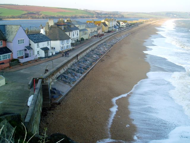
 |
| The beach at North Hallsands, Devon - a survey site on the Coastal Management Day |
Subscribe to:
Posts (Atom)