 |
| Ready for an 8km hike along the coast |
|
|
Start Bay has to have one of the most beautiful of England's coastlines. Stretching from Start Point northwards, it has headlands, shingle bars, freshwater lagoons, attractive villages and even the lost village of Hallsands.
This last place was the scene of a Victorian melodrama, where honest fisher-folk were pitted against the power of an industrialist's money, the Royal Navy and the machinations of a secretive and uncaring British government. Needless to say, the villagers lost, their village was destroyed by the sea, their compensation meagre and justice denied by the government's suppression of a report that recommended a far more generous settlement. The story is told very well by new interpretation boards on the viewing platform overlooking the ruins. The full story can be seen at the excellent website, .
http://www.abandonedcommunities.co.uk/hallsands6.html.
 |
| The remains of Hallsands village - from the viewing platform. |
On to North Hallsands, where the cottages were built to rehouse some of the displaced inhabitants of the abandoned Hallsands. The beach sediment is exceptionally low and it has exposed layers of peat which are normally covered by shingle. It makes the tragedy of Hallsands even easier to visualise when compared with previous years, as the following two photos show.
 |
| North Hallsands beach 11.02.2009 |
 |
| North Hallsands beach 12.02.2013 |
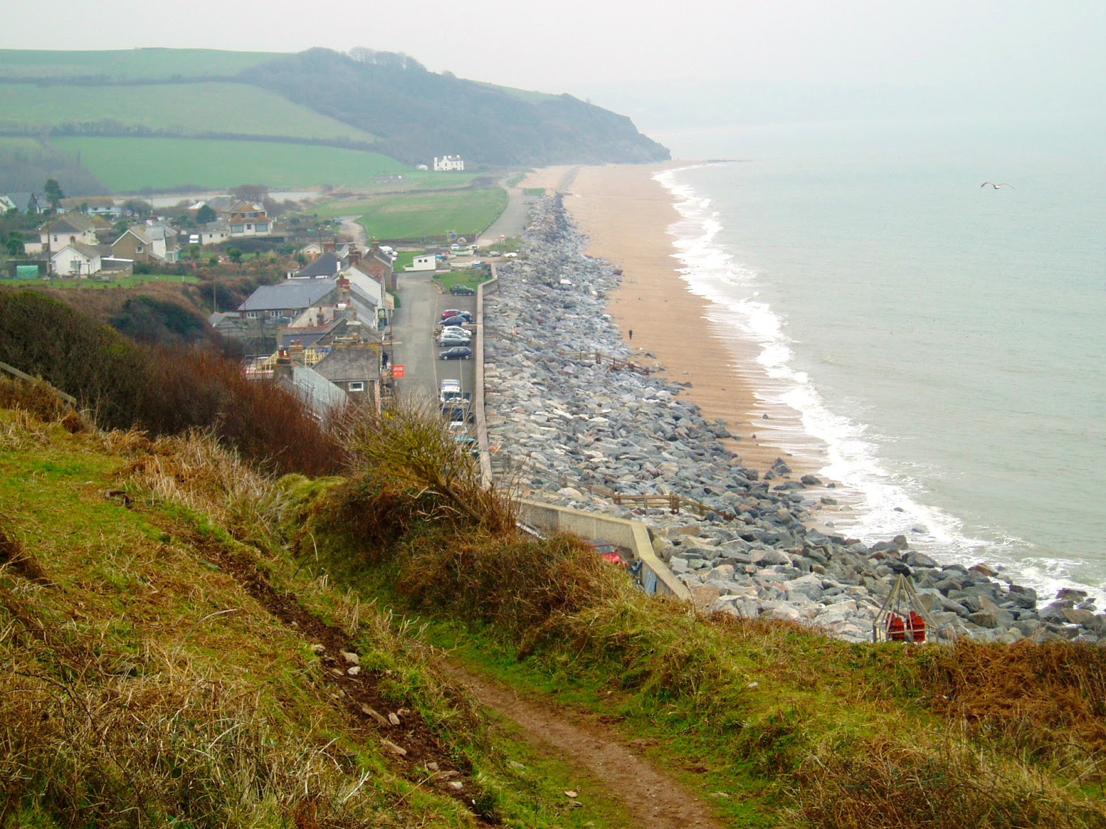
At the village of Beesands, the picture was the same, the beach being dramatically lower than in previous years.
 |
| Beesands showing the exposed rock armour in front of the sea wall. |
 |
| The rock armour and sea wall 12.02.13 and compare this with the photo below taken in roughly the same place (look for orange rock). |
 |
| Beesands 09.02.11 |
On to Torcross and the dramatic fall in beach level has exposed the foundations of the large sea wall constructed after the storm of January 1979 nearly destroyed the village.
(Video courtesy of Slapton Field Centre)
These photos show the situation.
 |
| View north 12.02.13 - the sea-wall foundations are exposed. |
|
 |
| Torcross beach on 11th February 2009 - the shingle is piled up against the wave return wall. |
 |
| Torcross beach 12.02.13 - the same spot as above - note the derrick which is also just visible on the left hand side of the photo above. The beach must be about 3m lower than in 2009. |
 |
| Shingle bastion at the Monument car park. A soft engineering method that replenishes the beach with material ferried down from the northern end at Strete Gate. Longshore drift will carry it northwards again, so keeping the beach material within its sediment cell. |
 |
| Slapton Ley 12.02.13 |
 |
| Paragliders near Start Point. |


No comments:
Post a Comment